[Region]
Margaret River Beaches: The Complete Region Guide
From Bunker Bay in the north to Augusta in the south, a furniture maker's read on which beach to pick, when, and why most visitors only see two of them.
 · by Sam Wilson · CC BY-SA 2.0")
People ask me which beach. It's the wrong question. The right question is which beach for what — and what time of day, and what kind of person you are when you're at the beach.
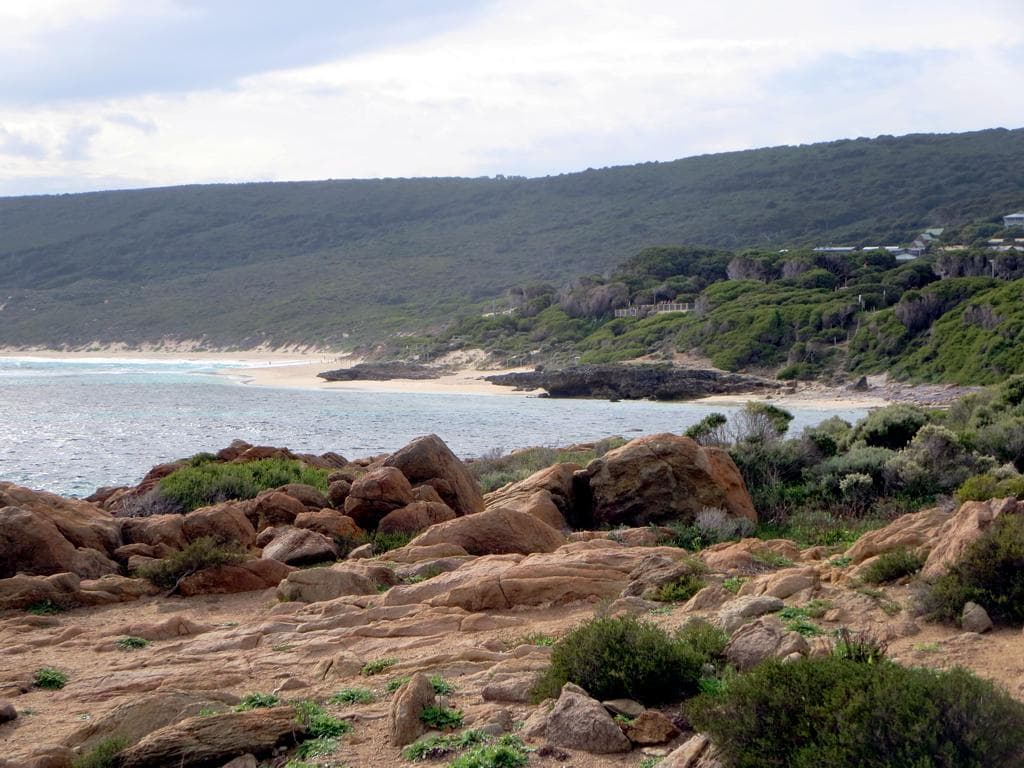
Photo: David Stanley, CC BY 2.0 · via Wikimedia Commons
The Margaret River region runs from Bunker Bay in the north to Augusta at the bottom of the cape, about 110 kilometres of coast. People say "Margaret River beaches" as if there's one type. There isn't. The north end is sheltered, north-facing, and gentle. The south end is wild, west-facing, and exposed. The middle is where most of the surfing reputation comes from. The lot of it sits inside the Leeuwin-Naturaliste National Park, looked after by DBCA, and you can drive between the two ends in under two hours if you don't stop.
The trick is knowing which one is doing what on the day you're here. Wind from the south-east turns Smiths into a millpond and makes Bunker Bay choppy. Wind from the west does the opposite. A big southern swell shuts down the surfers at Yallingup and lights up Margaret River Mouth. A flat calm day makes Injidup's natural spa pointless and the Aquarium at Yallingup beautiful.
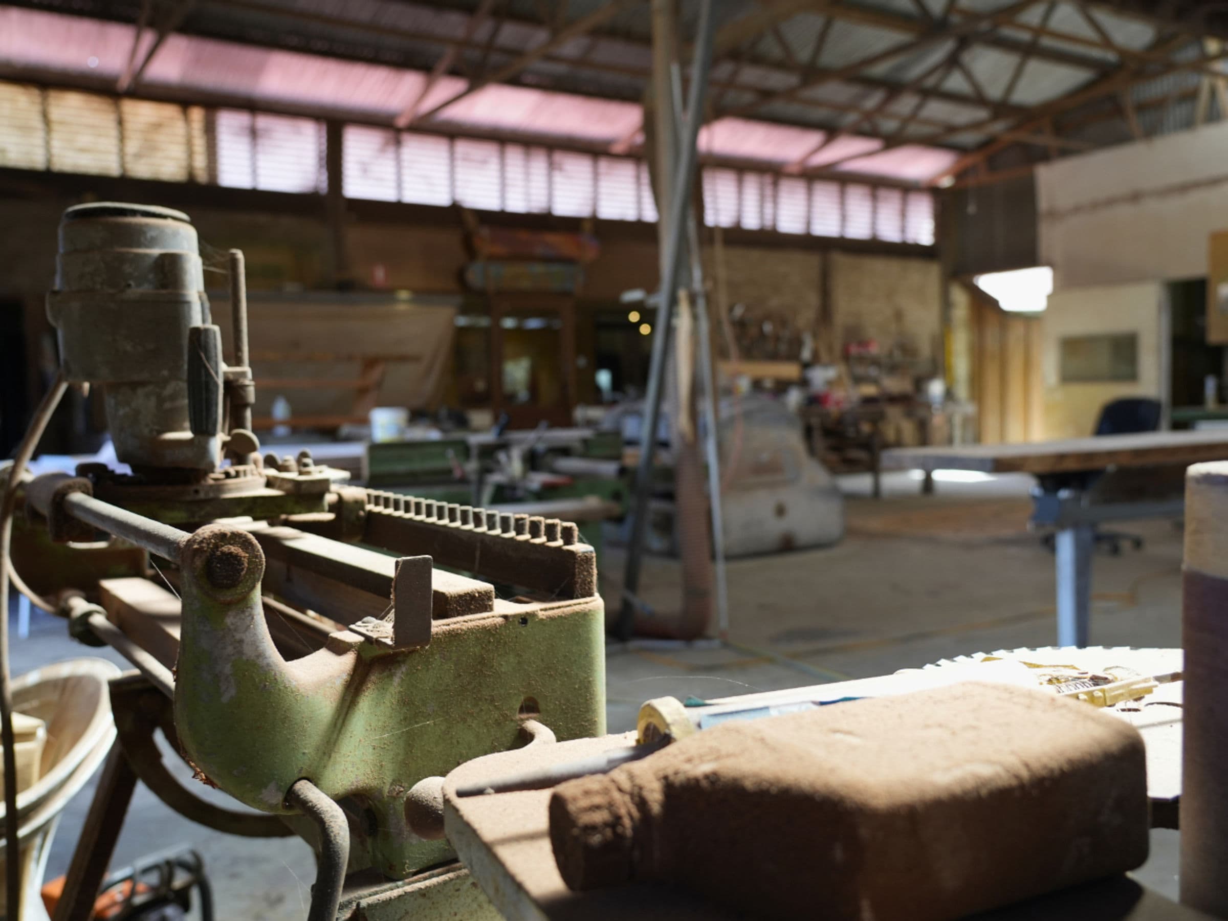
I've been working from a bench on Blythe Rd, Yallingup Siding, for forty years. The workshop went up in 1988. In that time I've watched cars get smaller and the carparks get bigger and the cafes come and go. The beaches themselves are largely the same. The way the light hits a granite headland at first light, the way the swell wraps a reef on a southwest groundswell, the way the dune grass goes silver in November. None of that has changed.
What follows is the long answer to the wrong question. North to south, with notes.
The lay of the land
If you draw a line from Cape Naturaliste at the top to Cape Leeuwin at the bottom, you've roughly drawn the shape of this stretch of coast. The west side faces the Indian Ocean and gets the swell straight off the Southern Ocean. The north side, tucked behind Cape Naturaliste, faces Geographe Bay and gets almost no swell at all. That's the big distinction.
Beaches on the north side (Bunker Bay, Meelup, Eagle Bay, Dunsborough town beach) are calm, sheltered, family-friendly, and they face north-east — meaning the sun does interesting things there at sunrise and the wind matters less.
Beaches on the west side (Yallingup, Smiths, Injidup, Gracetown, Prevelly, Redgate) are the ones you've seen in the surf magazines. Bigger swell, more dramatic, more dangerous if you're not paying attention, more rewarding if you are.
The middle bit, where the cape turns south, is where most of the famous breaks sit. Surfers' Point at Prevelly is where they run the Margaret River Pro. Yallingup is where they ran the first surf comp in WA. Smiths is where I'd take a beginner who knew what they were doing.
Three things drive every decision about which beach on the day:
- Wind direction. South-easterly: north and west beaches both good. Westerly: north beaches good, west beaches blown out. Northerly: rare in summer, west beaches glassy. South-westerly: the default summer afternoon, west beaches windy and the north side is your friend.
- Swell size. Under a metre: anywhere swims well. One to two metres: stay off the outer reefs but the bays are fine. Three-plus: respect the rips and don't get cute on the rocks.
- Tide. Matters less than people think for swimming, matters more for snorkelling, photographs, and getting close to the rock pools.
Surf Life Saving WA publishes a daily report. Worth looking at before you set out, particularly in summer when conditions move quickly.
The northern cluster: Bunker Bay to Dunsborough town
This is the calm end. North-east facing, behind the cape, family-friendly. If you're here with kids or a nervous swimmer, start here.
Bunker Bay
Bunker Bay sits right under Cape Naturaliste at the very top of the region. White sand, turquoise water on a still day, a long curve of beach broken by limestone outcrops at either end. The Pullman resort sits at the eastern end and there's a small cafe there if you want coffee after. The carpark is paid in summer, free in winter.
Bunker is sheltered from southern wind, which makes it the go-to on a windy summer afternoon when the west coast has gone to mush. On a flat calm day it's almost too calm — the water can look more like a swimming pool than ocean. Kids love it. Surfers ignore it. Snorkelling at the eastern end around Rocky Point is reasonable on a clear day.
Meelup Beach
Photo: Western Australian Government, CC BY 2.5 AU · via Wikimedia Commons
Meelup is fifteen minutes east of Dunsborough on the Meelup Beach Rd. Smaller than Bunker, more intimate, and the one I'd send a couple to. The beach itself is short, the sand fine, the water generally calm, and granite outcrops at the eastern end give you something to climb and look at. It faces north, which means at the end of the day the sun comes in along the beach instead of disappearing behind it. That's unusual for this coast and worth knowing.
There's no cafe on the beach. There's a kiosk in summer. The carpark fills early on weekends in January. If you can be there before nine you'll have the place. By ten on a hot Saturday it's all of Perth.
Eagle Bay
Eagle Bay sits five minutes further east again. It's similar to Meelup but quieter, with houses behind the dunes rather than open bush. The swimming is excellent. There's a small swimming pontoon offshore in summer, set up by the bay's residents association, and it's a marker for kids learning to swim out and back. Eagle Bay Brewing Company is a kilometre back from the beach and it's the way most people end an Eagle Bay afternoon.
Dunsborough town beach
The town beach at Dunsborough is the most accessible water in the region. Park at the foreshore, walk twenty metres, you're in the water. Geographe Bay, no surf, gentle on a kid. It's not the prettiest beach on the list (the town is right behind you and that changes the feel) but if you've got an hour and you want a swim and a coffee and an ice cream, it works. The Dunsborough Bakery is a couple of hundred metres back from the sand and they bake everything on site.
The Yallingup cluster: Smiths, Injidup, Yallingup main, Moses Rock
This is the stretch I know best. The cape turns south here and the coast opens up to the Indian Ocean swell. The beaches get bigger, the water gets bluer, and the rocks start doing things.
Smiths Beach
Photo: Sam Wilson, CC BY-SA 2.0 · via Wikimedia Commons
If you can only see one beach in the Yallingup cluster, Smiths is the one. Long crescent of white sand, headlands at either end, the Supertubes reef offshore making a line of white water on any decent swell, and on a half-tide there's a strip of beach where the swell rolls in and you can walk for a kilometre without seeing anyone. It's been my favourite since I arrived and the answer hasn't changed.
The north end (near the resort) is the swimming end. The south end is the snorkelling end on a flat day and the start of the walk to Injidup any day. The cafe at the Smiths Beach Resort, Lamont's, does breakfast from seven and they've got the deck that looks straight onto the swell. It's the best Saturday morning coffee in the region. The longer piece on Smiths covers it in full.
Injidup
Injidup is a category of its own. The main beach sits south of Smiths and you can either drive down via Injidup Beach Rd off Caves Road, or walk the Cape to Cape track from Smiths south for about an hour. The walking option is better if you've got the time — the cliff walk between Smiths and Injidup is some of the best coastal walking in the country.
The famous bit is the natural rock spa at the northern end, a saltwater pool carved into the granite that fills with each wave and bubbles like a hot tub. Calm days only. On a big swell the spa is unusable and dangerous. Mid-tide is the window — full high washes you out, dead low drains the pool. The practical guide to finding the spa goes deeper.
The beach itself, south of the spa, is one of the most beautiful in the region. South-facing, exposed, often empty, and the water colour on a calm day is the cleanest blue I see anywhere on this coast.
Yallingup main
Photo: Lasthib, CC BY-SA 4.0 · via Wikimedia Commons
Yallingup main beach is where the surfers go. The wave breaks off the reef about three hundred metres offshore and on a clean four-foot swell it's one of the best mid-length lefthanders in the country. The first surf competition in WA was held here in 1956. The Yallingup Boardriders is still going.
For non-surfers the beach has two characters. The right-hand side (north) is the Yallingup lagoon — protected by the reef, calm, swimmable, great for kids. The left-hand side (south) is where the swell comes ashore and you get a proper beach break, more interesting for bodysurfers and intermediate surfers than for kids paddling.
There's the bakery up the hill (Yallingup Woodfired Bread) which you go to for the bread, not the seating. And the Caves House Hotel a kilometre back, which is a different topic entirely.
Moses Rock
Moses Rock is half an hour south of Yallingup, signposted off Caves Road. Almost no one goes there. Limestone reef, a small beach, very exposed. On a big southwest swell it's an outer reef that holds size and the surfers know about it. On a flat day it's a snorkel spot and a rock-pool spot with no one around. I'd rate it as the most underrated beach on the list.
If you're going, take water, take shoes, and don't take small kids. The track down is steep and the rocks are sharp.
The wild south: Canal Rocks down to Redgate
South of Yallingup the coast gets harder. The beaches are bigger, less sheltered, and the water has more weight in it. This is also where the surf reputation lives.
Canal Rocks
Photo: Lasthib, CC BY-SA 4.0 · via Wikimedia Commons
Canal Rocks sits between Yallingup and Wyadup. It's not really a beach — it's a series of granite outcrops with channels cut through them by the ocean — but it deserves the inclusion because it's one of the things every visitor should see. Free entry, small carpark, two-minute walk to the bridge, and the swell does the rest of the work. The sunset version is when most people see it best. Twenty minutes from the workshop on Blythe Rd.
Gracetown and Cowaramup Bay
Gracetown is the small village halfway between Yallingup and Margaret River town. The bay it sits on is called Cowaramup Bay, and on a small swell day the south end is one of the best swimming beaches on the western coast. The northern end (Huzzas Beach) is the surfing end, with a sand-bottom break that suits intermediate surfers well. There's no cafe on the beach but the general store at the top of the village does coffee.
A note on Gracetown that needs saying: there have been shark incidents here. Two fatal in the last twenty years. Don't go in alone, don't go in at dawn or dusk, and check the Surf Life Saving WA updates before you swim. That goes for the whole coast but it's most relevant here.
Prevelly and Surfers' Point
Prevelly is the surf town at the mouth of the Margaret River. Two beaches matter here: the river mouth itself (where the river meets the ocean and you get a calm river bath behind a sand bar) and Surfers' Point, the reef break a kilometre north where they run the Margaret River Pro every March or April.
Surfers' Point on a four-foot southwest swell is the cleanest wave in the country. It's not a beginner's wave. Watch from the carpark above. The river mouth, by contrast, is the safest swim on the wild south end of the coast, particularly for kids — the sand bar drops the swell and the river water is warmer than the ocean.
Redgate
Redgate is fifteen minutes south of Margaret River town and it's the last of the well-known beaches before the coast goes quiet. Long, exposed, occasionally heavy surf, often empty, often spectacular. The dune behind the beach is one of the bigger ones in the region. There's a small carpark and basically no infrastructure.
Past Redgate you're into the southern stretch — Boranup forest meets the coast, the beaches get harder to reach, and most visitors don't make it. Hamelin Bay (with the stingrays in the shallows), Cosy Corner, Augusta. Each worth a day on its own. None of them quick day-trip territory from the Yallingup end of the cape.
How to choose: the question framework
For families
Top three: Meelup, Bunker Bay, Yallingup lagoon (north end). All sheltered, all calm in most conditions, all with toilets and carparks. Smiths north end as a fourth if the swell is small.
For surfers
Yallingup main on a four-foot southwest. Smiths' Supertubes if you've got the skills for an outer reef. Margaret River Mouth (the rivermouth break, not Surfers' Point) for fun beachbreak conditions. Huzzas Beach at Gracetown on a clean east wind. Moses Rock on a big day if you know somebody who knows the entry.
For swimmers
Dunsborough town beach for the warmth and the calm. Meelup for the same plus a granite view. Smiths north end for the open ocean version. Eagle Bay for the laps. Avoid anywhere with a reef break offshore unless you know how rips work.
For photographers
Sugarloaf Rock at first light. Canal Rocks an hour before sunset. Smiths from the southern headland at sunrise. Injidup spa on a mid-tide calm day, from above. Sugarloaf and Canal Rocks both worth the drive on their own — the photography rundown has the longer take.
For people who want to be alone
Moses Rock most days. Redgate in winter. Injidup beach south of the spa on a weekday. The walk south of Smiths along the Cape to Cape track — by an hour out from the carpark you'll have the coast to yourself. Bunker Bay before eight on a winter weekday. There's plenty of solitude available; you just have to take a small walk for it.
Wind from the south-east turns Smiths into a millpond and makes Bunker Bay choppy. Wind from the west does the opposite. Pay attention to the wind first, the swell second, the tide third.
Practical bits
Parking
All of the named beaches above have public parking. Most are free. Bunker Bay charges paid parking in summer. Margaret River Mouth fills early on a swell day. Meelup fills early on a still summer weekend. The rest are usually fine.
Tides
Tide variation on this coast is small (around one metre at the largest spring tides), so it doesn't matter as much as it does on the east coast or up north. It matters for snorkelling (better at low to mid), for rock pools (clearly low), for the Injidup spa (mid), and for photographing Canal Rocks (any tide works, but a low tide on a calm day lets you see down into the channels).
Seasonal conditions
- Summer (December–February): warm water (around 21°C), reliable swimming weather, busy. South-westerly sea breeze every afternoon. Mornings are gold; afternoons go windy.
- Autumn (March–May): the best season. Water still warm, swell coming up, crowds gone after Easter. April light is the cleanest of the year.
- Winter (June–August): big swell, cold water (around 16°C), often empty beaches. Good for storm-watching. Wetsuit on for surfers, hot shower after for everyone. Storms come through about every five days.
- Spring (September–November): whales offshore (Cape Naturaliste lookout is the prime spot), wildflowers along the cliffs, water warming up again. Often the best month if you want everything at once.
Rips
A rip is the column of water heading back out to sea after a wave's come in. They show as smoother, darker water running between sandbars where the white water isn't breaking. The rule: if the water looks calmer than the water on either side, that's a rip. Don't swim there. If you're caught in one, swim parallel to the beach until you're out of it (it'll be 20–30 metres wide), then swim back in. Don't try to fight it directly. Most rip drownings on this coast are people fighting the current instead of swimming sideways.
Safety in general
Surf Life Saving patrols Smiths and Yallingup in summer, weekends only in some months. Most of the rest of this coast is unpatrolled. The general rule: if you don't know the beach, don't swim alone, don't swim at dawn or dusk, and keep an eye on conditions changing through the day. The Indian Ocean is not the Mediterranean. Respect it and it'll give you a lot back.
Where the gallery fits
Our gallery on Blythe Rd sits between the northern cluster and the Yallingup cluster. If you're doing both in a day, we're the natural halfway stop. Come in and ask me which one is working this afternoon — I'll have looked at the wind already.
A lot of my time at the bench has been spent answering the same question from gallery visitors: which beach. The honest answer is that there are five or six I'd send you to depending on the day, and there's a couple I'd save for the kind of mood I think you're in.
If you've only got time for one and you don't know me, take Smiths. North end if the wind's southerly, south end if you want a walk. If you want two: Smiths in the morning, Canal Rocks an hour before sunset. If you want a week: do the lot. They're all within an hour's drive of each other.
If you want the narrower view, my Yallingup-only ranking takes just the six I know best.
What I'd do with a week
If a friend turned up for a week and asked what to do, I'd probably plan it like this:
- Monday: Smiths in the morning, walk south to Injidup, drive back. Recover with a coffee at the workshop in the afternoon.
- Tuesday: Bunker Bay and Cape Naturaliste lighthouse. Lunch at the brewery at Eagle Bay.
- Wednesday: Yallingup lagoon and the Aquarium with snorkels.
- Thursday: Canal Rocks and Sugarloaf. Sunset somewhere along the cape.
- Friday: drive south, Gracetown for lunch, Surfers' Point for the afternoon, river mouth for the swim.
- Saturday: Redgate and Boranup forest. A long, slow loop back via Caves Road.
- Sunday: pick whichever one was the best on the trip and go again.
You can do the lot in three days if you have to. You'll get more out of it across a week.
The beaches don't ask anything of you. You park, you walk, you swim, you watch. The Indian Ocean does the rest of the work. That's been the answer since I arrived, and it'll be the answer long after I'm finished at the bench.
Read next
For the Yallingup-only narrow take, see the six beaches I know best. The sunset comparison sets Canal Rocks against Sugarloaf and Smiths. My pick is still the longer piece on Smiths. And for the most beautiful single feature on this stretch of coast, the Injidup natural spa.
For the Tourism WA version, the official site has the broad sweep. It's a different angle to mine.

Plan your visit to Yallingup.
Directions & hours →