[Region]
Sugarloaf Rock at Sunset: Everything You Need to Know
A granite stack the Southern Ocean has been working on for ten thousand years, about half an hour from my workshop, and the easiest sunset in the South West.

Sugarloaf Rock doesn't ask anything of you. You park, you walk five minutes, you're standing in front of something the Southern Ocean has been carving for ten thousand years.
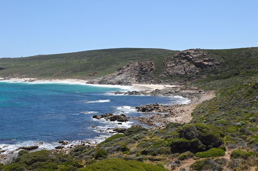
Photo: Stuart Sevastos, CC BY 2.0 · via Wikimedia Commons
I'd put Sugarloaf in the small group of places I take every visitor to. Cape Naturaliste, Smiths Beach, Canal Rocks, Sugarloaf. The four corners. If you have one evening in Yallingup and want the best fifteen minutes of light you'll see this week, Sugarloaf is the answer.
What it is and how to get there
Sugarloaf Rock is a granite stack standing about sixty metres tall, a couple of hundred metres off the coast, between Yallingup and Cape Naturaliste. It's part of the Leeuwin-Naturaliste National Park, managed by DBCA, and access is free.
From the gallery on Blythe Rd, it's about half an hour. Head out to Caves Road, north to Cape Naturaliste Road, and Sugarloaf is signposted on the left before you get to the lighthouse. The car park is small and sits up on the cliff above the rock. There's a viewing platform a couple of minutes' walk from the car, and a short track that drops down to a lower viewpoint where you get the full height of the stack against the sky.
Google Maps sometimes misdirects via Wildwood Rd. Stay on Bussell Hwy, turn at the Carbunup store, then Blythe Rd, then out to Caves Road. Once you're at Cape Naturaliste Road, the signage is reliable.
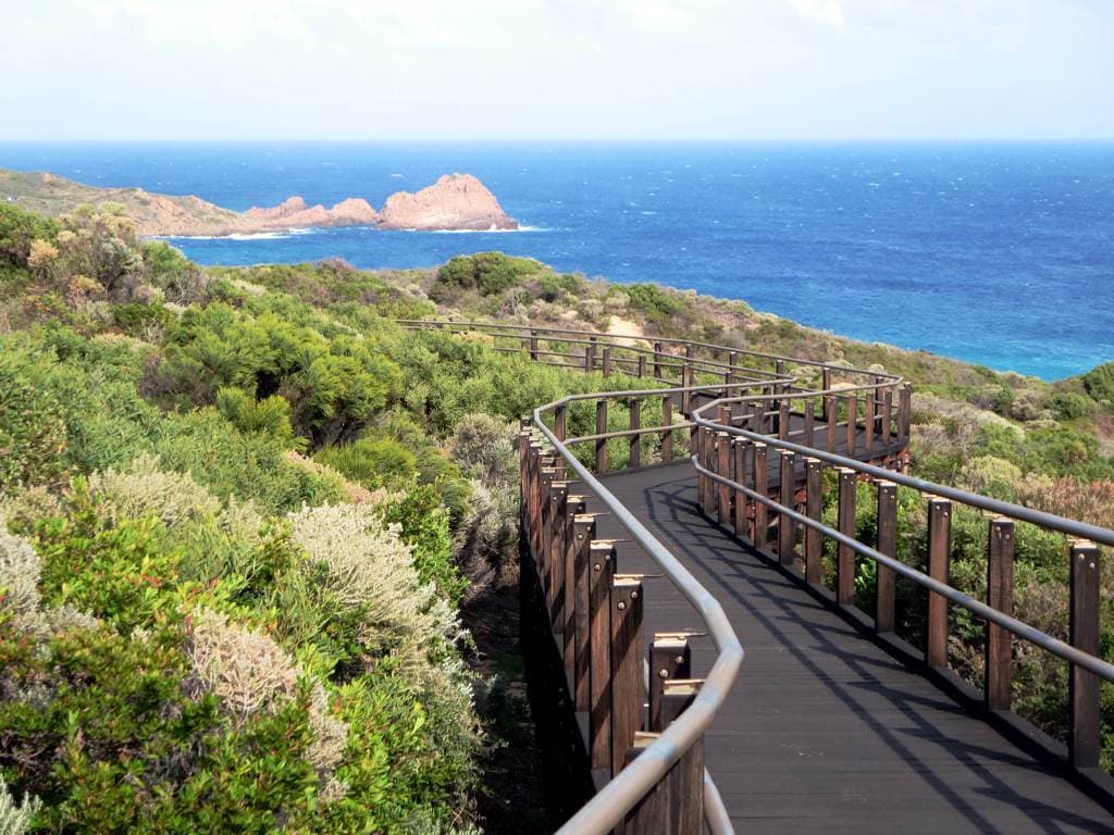
Photo: David Stanley, CC BY 2.0 · via Wikimedia Commons
To do it properly, walk in. The Cape to Cape track passes within a short distance of the rock, and the approach on foot through the coastal heath is better than the approach by car. Park at the Cape Naturaliste end and walk south, or park at Sugarloaf and walk a kilometre north along the track before doubling back.
When to go
For a sunset, half an hour before the sun goes down is when you want to be parked. Give yourself ten minutes to walk to the platform and find your spot. Stay until ten minutes after. That's when the colour comes back into the sky from the west and the rock turns the colour you'll remember.
In summer that means parking around 6:30. In autumn (my favourite time of year for this whole coast) around 5:30. In winter, around 4:30.
The other window worth knowing is sunrise, particularly in autumn. The light comes from behind the cliffs and lights up the rock from a side you don't see at sunset. Most people don't get up for it, which is exactly why it's worth doing.
The Indian Ocean has been working on this rock for ten thousand years. You can give it half an hour.
What it does to you
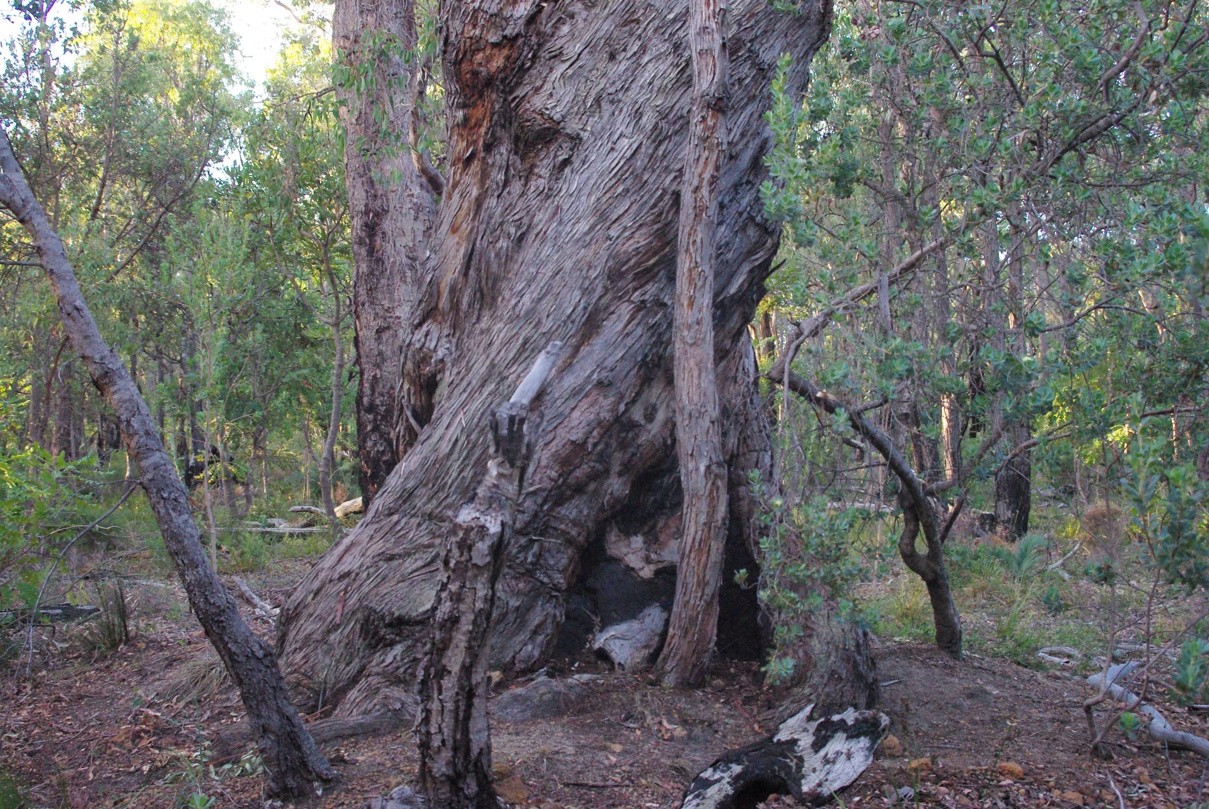
A designer's eye gets used to looking at form, and Sugarloaf has it. The granite is layered and worn. You can read the geology in it the same way you can read the grain of a piece of timber. The base is undercut by the swell, the top is rounded by weather, and the whole thing leans very slightly. It looks like an object somebody made, and then realised was being unmade by the ocean.
There's something useful in seeing that. Most things people pay attention to are new. The rock is old. The wood I work with is old. The granite the gallery sits on is old. Standing in front of Sugarloaf for fifteen minutes does for a person what walking through the bush does. It puts you back in proper time.
Photo: Stuart Sevastos, CC BY 2.0 · via Wikimedia Commons
Combine it with Cape Naturaliste
The single best move at Sugarloaf is to go on the same evening as Cape Naturaliste Lighthouse. They're on the same road, five minutes apart. The full lighthouse take is its own piece. The short version: do the lighthouse late afternoon (last tour times shift seasonally, check ahead), then drive five minutes back south to Sugarloaf for the sunset. The lighthouse gives you the panoramic view across Geographe Bay; Sugarloaf gives you the singular object. You want both.
With Canal Rocks also on your list, Canal Rocks when the light is right. Don't try to do Canal Rocks and Sugarloaf in the same evening. Pick one. They're both single-sunset places.
Whale season
September to early December is whale season along this coast. Humpbacks and southern right whales move up and down past Sugarloaf as part of their migration. From the viewing platform, on a clear day, you can often spot them: sometimes just a spout, sometimes a tail, sometimes a full breach if you're lucky.
Bring binoculars if you've got them. The whales are usually further out than you expect. For a more reliable whale-watching setup, the Cape Naturaliste headland is the better vantage. See the whale-watching write-up. But on a good evening, Sugarloaf will do.
A note on photography
I'm a furniture maker, not a photographer. But the questions people ask in the gallery about shooting Sugarloaf come up enough that I've got opinions.
- Don't shoot from the platform. That's the postcard. Drop down to the lower viewpoint where you can frame the rock against the sea, not the sky.
- Bring a wide lens. The scale is the thing.
- Wait. The best shot is almost never the first one. Stay until ten minutes after the sun has gone. The colour at that point is the colour worth taking home.
- Mind the wind. Sugarloaf is exposed. A tripod can blow over. Weight it.
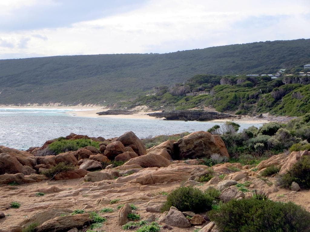
Photo: David Stanley, CC BY 2.0 · via Wikimedia Commons
Practical bits
Background on the park itself is on the Leeuwin-Naturaliste National Park page, and general orientation on Sugarloaf Rock Western Australia tourism pages.
On the way home
Coming back through Yallingup Siding, Blythe Rd is right there. Our gallery is open until 5 most days — earlier than the sunset crowd usually reaches us, but it's worth knowing that combining Sugarloaf with the lighthouse and wanting to see the workshop means coming through before late afternoon. Or schedule it the other way around: gallery first, then drive out to the coast as the light goes.
For the broader context of where Sugarloaf sits in the local coastline, the broader beach guide is the place to start. There's a lot of granite on this coast, and Sugarloaf is just the most famous bit.
The rock doesn't change. The light changes every day. That's the thing about coming back: same view, different photograph, different evening. Four decades on Blythe Rd and I still go.
Eagle Bay catches the same kind of light in the morning, for visitors staying nearby who want to keep going.
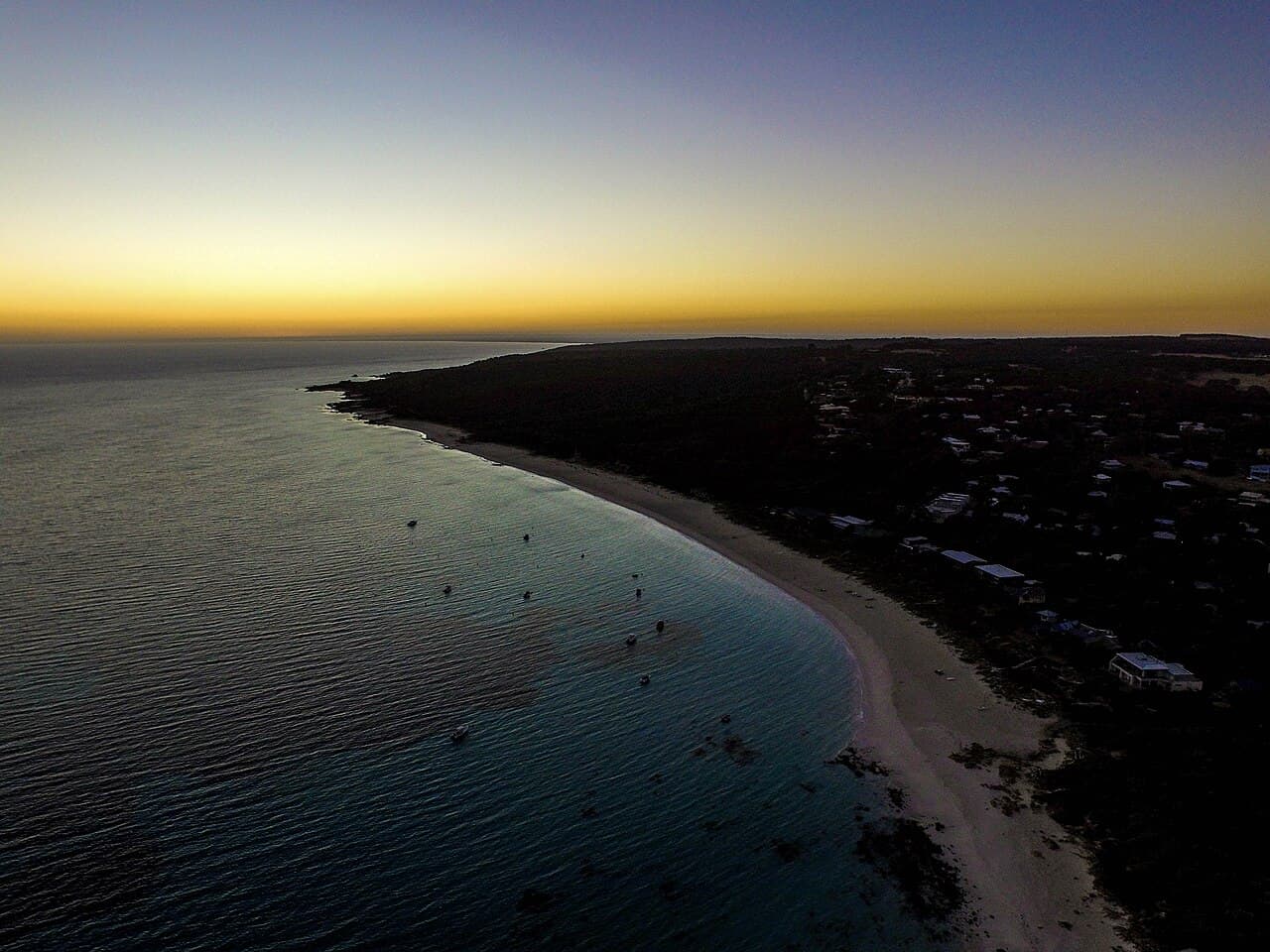
Photo: Harry Foley, CC BY-SA 4.0 · via Wikimedia Commons
Plan your visit to Yallingup.
Directions & hours →