[Region]
Cape to Cape Track: Where Walkers, Whales and Galleries Meet
The track passes within three kilometres of my front door. A walker's guide from someone who lives on the line, written for the ones who stop in Yallingup Siding.

The Cape to Cape Track passes within three kilometres of my front door. The ones who stop in Yallingup Siding have a better story to tell at the finish line.
I've walked sections of it more times than I can count. Not the whole thing in one go. I'm a furniture maker, not a long-distance walker. But the part that runs along my stretch of coast I know in every season. I walk it in autumn when the light is at its best. I walk it after a southerly when the air has cleared. I walk it when a piece on the bench isn't telling me what it wants, and I usually come back knowing.
This is a walker's guide for the section that passes through Yallingup. It's also a guide for the ones doing the full track who want to know where to stop and what's worth a half-day off the trail.
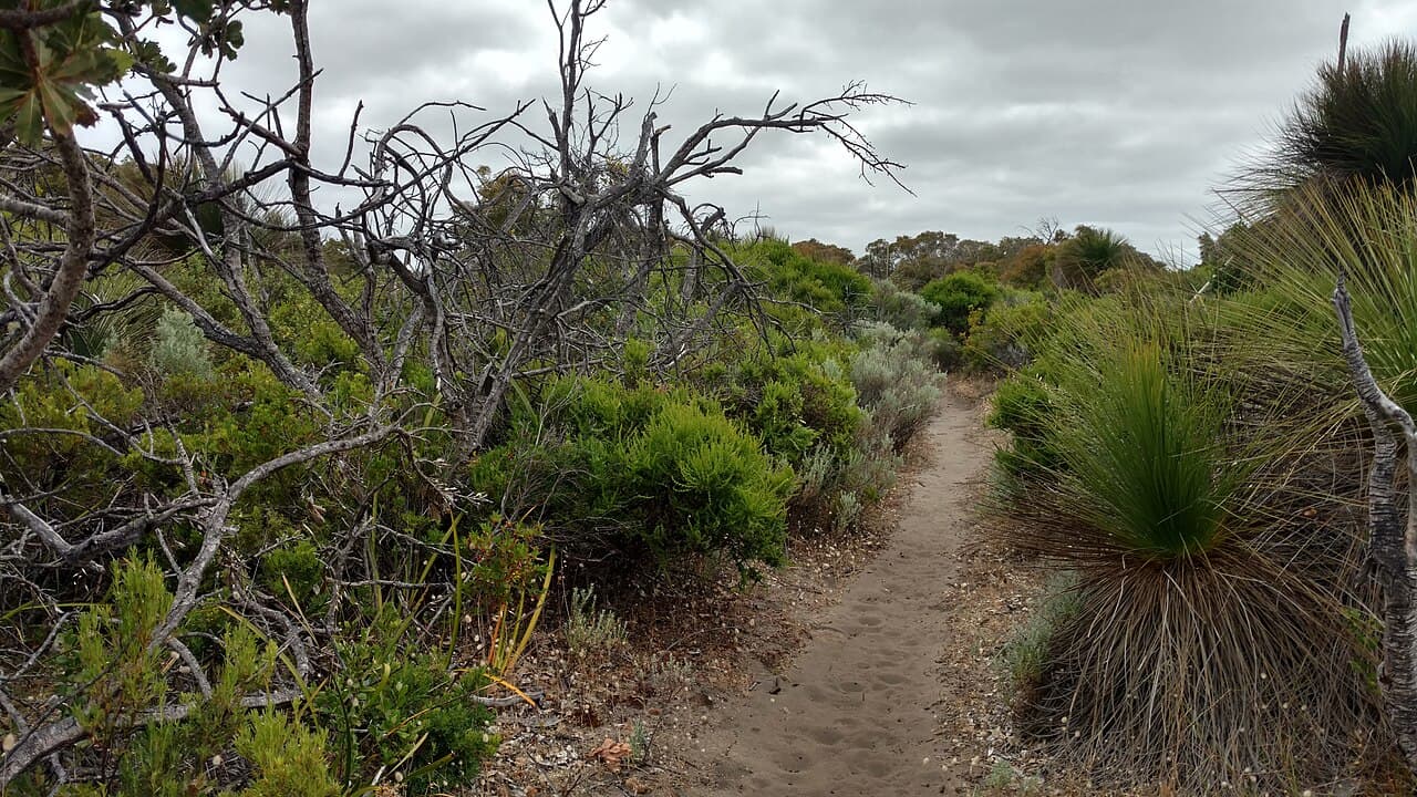
Photo: Lasthib, CC BY-SA 4.0 · via Wikimedia Commons
The basics
The track runs about 135 kilometres from the Cape Naturaliste lighthouse in the north to the Cape Leeuwin lighthouse in the south. It's managed by the Department of Biodiversity, Conservation and Attractions (Explore Parks WA on their website). The full thing takes most walkers five to seven days end to end. Most people don't do the whole thing; they walk sections.
The track is well-marked. Yellow triangles on posts. You don't need a guide to walk it. You do need water, a hat, a windproof, and decent shoes. The surface ranges from beach sand to limestone to boardwalk to bush track, sometimes within the same kilometre.
There are campsites along the way for through-walkers. There are also towns and villages where the track crosses or near-crosses civilisation. Yallingup is one of them, and one of the best for a stopover, which is the whole point of this post.
The section through Yallingup
The track enters the Yallingup area from the north having come down from Cape Naturaliste, through Sugarloaf Rock and the Three Bears surf breaks. It hits Smiths Beach. It then climbs out and runs south along the cliffs toward Canal Rocks and beyond.
The Yallingup section is one of the most photographed on the whole track for a reason. The cliffs are dramatic. The granite formations at Canal Rocks are unlike anything north or south. The view from the Sugarloaf Rock section gives you what the Indian Ocean actually looks like when it's working. Big sets rolling in from a thousand kilometres of fetch, hitting limestone that's stood there for a long time.
A good day walk: park at Cape Naturaliste, walk south to Sugarloaf Rock, continue down to Smiths Beach. That's about 13 kilometres. Strong walkers can keep going to Canal Rocks for another 4. Catch a lift back. It's worth pre-arranging because the road network doesn't loop you back conveniently.
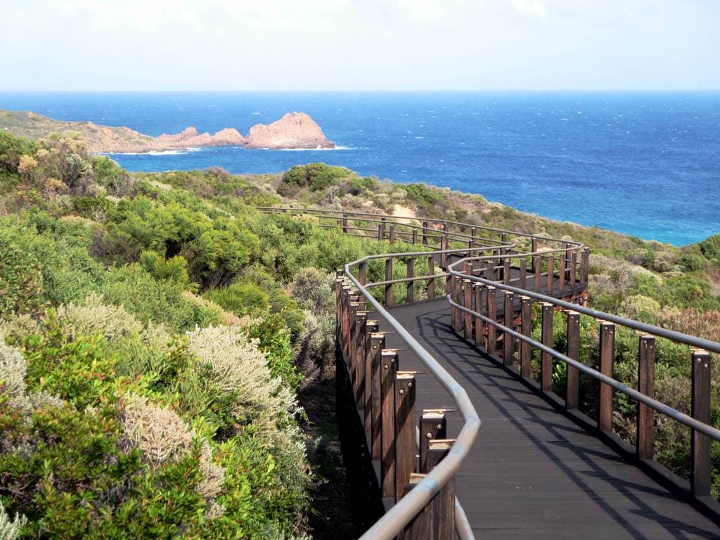
Photo: David Stanley, CC BY 2.0 · via Wikimedia Commons
Whales
A note for the seasonal walkers. Between June and roughly November, you'll see whales from the track. Humpbacks and southern rights migrating up and down the coast. Calving in the bays. The Cape Naturaliste end is a good vantage. The Sugarloaf Rock section is better than good. Some days you'll see twenty or thirty animals in an afternoon.
If whales are why you're walking, time your visit between September and early November. That's the south-bound migration, and the mothers are travelling with calves. Slower. Closer in. Easier to see. I've been working in our gallery and seen them from the workshop window on a clear day. The track gets you closer.
For the longer version on whale watching specifically, the whale-watching write-up.
What the track does for you
I'll get sentimental for a paragraph because the track deserves it.
The Cape to Cape walk does a particular thing to your head. There's the obvious: the views, the air, the exercise, the satisfaction at the end of a long day. There's also the less obvious. The track puts you in a relationship with the coast that you don't get from a car park. The granite at Sugarloaf isn't the same granite from the road. It's older when you've walked four kilometres to reach it. The water at Smiths Beach looks different after you've descended the cliff path to get there.
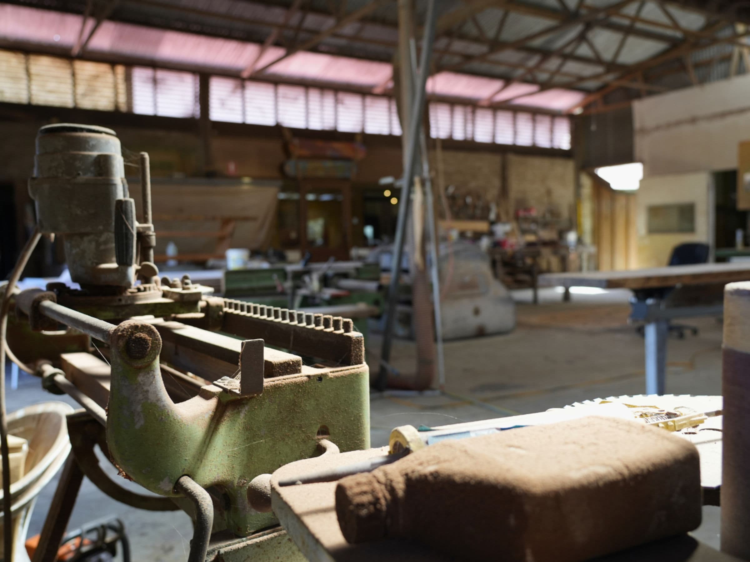
I make furniture for a living. Most of what I know about reading a piece of timber I learned at the bench. But a meaningful chunk of what I know about reading a landscape, about understanding why a slab of jarrah looks the way it looks, I learned walking this track. The track is what tells you what the country actually is. The wood is just the country put into a board.
The Cape to Cape walk changed how I think about design. The views do something to you. They always have.
Stops worth making
The ones who walk straight through without stopping miss most of the point. Here are the stops I'd build into a Yallingup-section day or two.
Cape Naturaliste lighthouse
The northern trailhead. There's a small visitor centre with a cafe and a museum about the lighthouse. The lighthouse tour is worth the half-hour if it's running. Park here, have a coffee, then start the walk south. the full take on the lighthouse
Sugarloaf Rock
About forty minutes south of the lighthouse on the track. The rock itself is one of the most photographed coastal features in WA. There's a viewing area accessible by car for non-walkers; the walkers see it from above on the cliff trail, which is the better angle.
Three Bears / Yallingup main break
Surfers will be drawn to this stretch for that reason alone. Non-surfers should still stop for ten minutes. The local crew are good and the breaks are dramatic.
Smiths Beach
The track drops down to beach level here. Smiths is my favourite beach in the region. I've said that publicly more than once. It's a long crescent of white sand between two limestone headlands. There's a small village, a couple of cafes, and accommodation if you need a bed. A swim at Smiths after fifteen kilometres on the cliffs is worth what you paid for it.
Blythe Rd, the gallery
This is the one most walkers don't know about. My gallery sits on Blythe Rd, about a kilometre inland from where the track passes through Yallingup proper. Walkers can detour off the track, come and see the workshop and our gallery, have a sit down with a glass of water, and walk back to the track in under an hour. Pam will meet you at the door. She usually gets the whole story out of walkers before I've looked up from the bench. The viewing window into the workshop is a good place to rest your legs and watch someone else do the work for a change.
John Streater Fine Furniture sits on Blythe Rd, about a kilometre off the Cape to Cape Track. Detour in for a glass of water and a look at the bench. Google Maps sometimes misdirects via Wildwood Rd. Stay on Bussell Hwy, turn at the Carbunup store, then Blythe Rd.
Canal Rocks
About four kilometres south of Yallingup. Granite formations split by a tidal channel that walks itself in and out with the swell. There's a small bridge across the channel that gives you the best photograph on this stretch of track. Half an hour here is enough.
Injidup Natural Spa
Another six or so kilometres south. A rock pool fed by an overwash channel from the open ocean. On a low swell day you can swim in it. On a big swell day you can sit and watch it fill and empty. Worth the diversion.
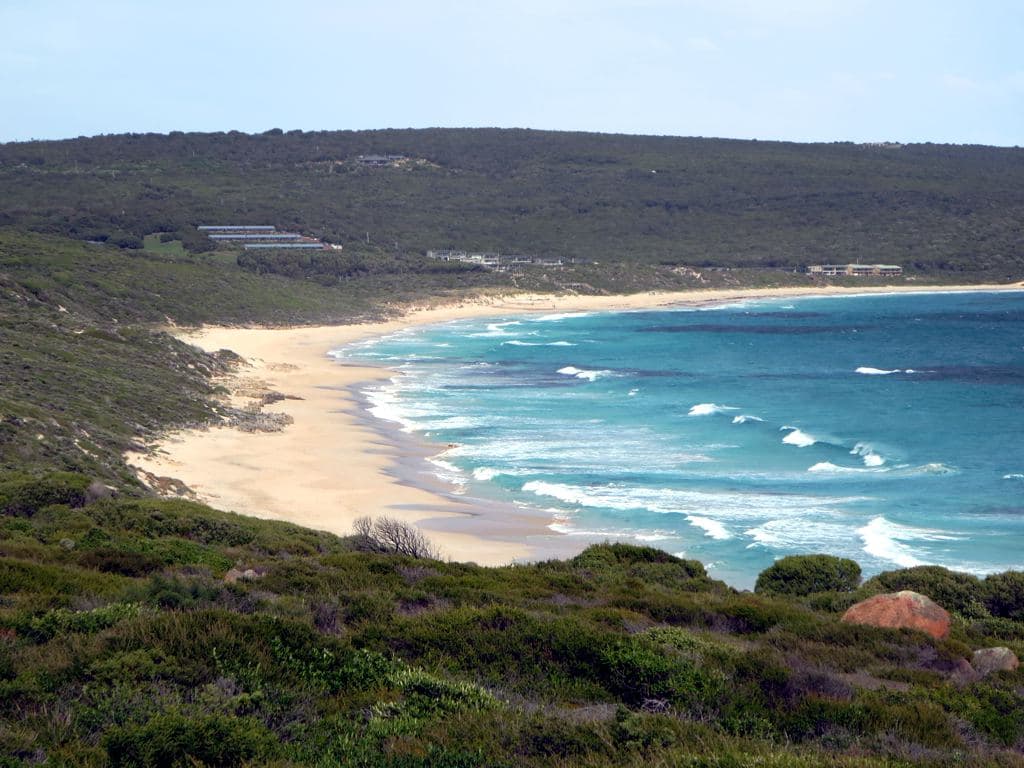
Photo: David Stanley, CC BY 2.0 · via Wikimedia Commons
Practical bits
Where to stay in Yallingup
Yallingup has accommodation across the range: bed and breakfasts, holiday houses, a couple of hotels, plus the campsites further south. Booking a night in Yallingup as a midway point on a longer walk is a smart move. You eat properly, you sleep in a bed, you re-supply at the local store, and you walk fresh in the morning.
Best time of year
Autumn is the best time, in my opinion. The light is at its best. The crowds are thin. The wind is usually offshore in the mornings. The wildflowers come out from August into October, which is also good, but spring brings the crowds. Winter is fine for the walking but you'll get rain, sometimes a lot of it.
Summer is the busiest. The walking is hot in the middle of the day. Walk early in January or February, and finish before midday.
One safety note
The cliffs are real cliffs. Stay back from edges, especially in wind. The track is well-routed and you don't need to go near the drop to get the view. People have died down here from getting too close. Don't be one of them.
What I'd say to a walker stopping in
If you're walking the track and you're passing through Yallingup, give yourself a day off the trail. Sleep in a bed. Eat a long lunch. Walk Smiths Beach without a pack. Come and see our gallery on Blythe Rd. Have a coffee at the Margaret River Farmers Market on Saturday morning if you're here for it.
The walkers who finish at Cape Leeuwin and remember the trip best are the ones who stopped properly somewhere in the middle. Pace is part of the walk. Stopping is part of the walk.
I'll usually be in the workshop. Knock on the door.
Read next: Cape to Cape day walks near Yallingup.
Plan your visit to Yallingup.
Directions & hours →