[Region]
Cape to Cape Track Day Sections Near Yallingup
_The full Cape to Cape is 135km. Most people don't have a week. Here are the day sections near my workshop that give you the best of it without the logistics._

The Cape to Cape Track passes within a few kilometres of my front door. I've walked sections of it more times than I can count.
The full track is 135km from Cape Naturaliste in the north to Cape Leeuwin in the south. It takes most people five to eight days to walk end to end, carrying everything, sleeping at campsites along the way. It's a serious undertaking. I've done it in pieces, never as a through-walk, and honestly that's how I'd recommend most people do it.
The best bits of the track are the bits near Yallingup. I'm biased, I live here. But I've walked enough of the southern sections to know that the granite headlands, the karri pockets, the sequence of bays from Cape Naturaliste down to Smiths is the most varied stretch of the whole thing. You can sample it in a morning. You don't need a permit. You just need shoes and water.
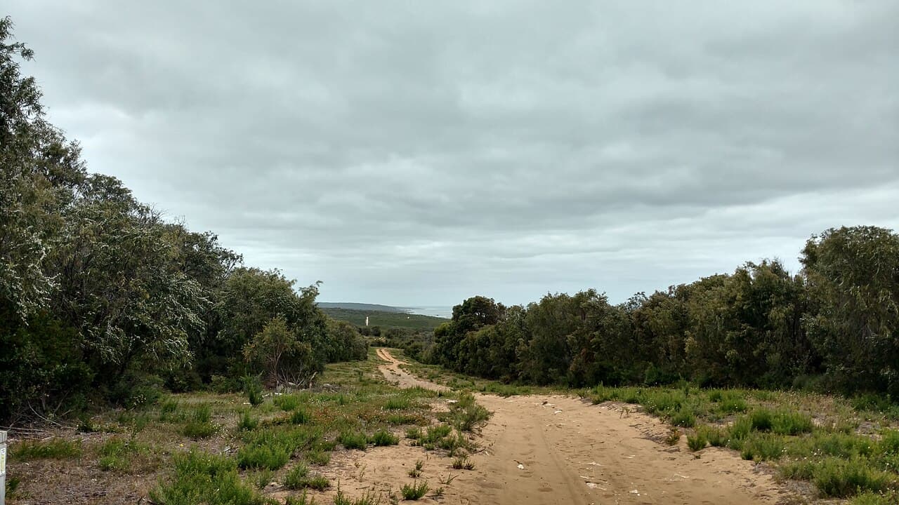
Photo: Lasthib, CC BY-SA 4.0 · via Wikimedia Commons
Section 1: Cape Naturaliste Lighthouse to Sugarloaf Rock
Distance: 3.2km one way (6.4km return) Time: 1.5 to 2 hours return Difficulty: Easy
This is the section to walk first, before any other. Park at the Cape Naturaliste lighthouse car park, take the marked Cape to Cape trailhead south, and follow the cliff line down to Sugarloaf.
The path is well-formed, mostly flat, and the views are continuous. You're walking along a cliff edge most of the way with the Indian Ocean to your west. In whale season (September through November) you'll see humpbacks tracking south. I've watched them from this section dozens of times. Bring binoculars but you usually don't need them.
Sugarloaf at the end is the payoff. Sea stack, viewing platform, full horizon. Sit down for ten minutes before turning round. The walk back has different light because the sun has moved.
This is the section to do with kids, with grandparents, with anyone who's not sure about a long walk. It's gentle and the rewards come at the start, not the end.
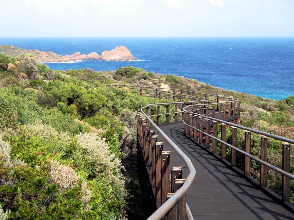
Photo: David Stanley, CC BY 2.0 · via Wikimedia Commons
Section 2: Sugarloaf Rock to Yallingup
Distance: 8km one way Time: 3 to 4 hours Difficulty: Moderate
This is the next step up. South from Sugarloaf, the track drops down off the headland, crosses some heath, then climbs back up to follow the cliffs above Yallingup beach.
It's longer than it sounds. The track surface gets less consistent: some loose sand, some rocky sections, a few short climbs. Not technical, just less paved. You'll need to commit a half day.
What you get in return is the most underrated section of the track. The view as you come around the headland and see Yallingup beach laid out below is one of those views you remember. There's a working farm on your left for part of the walk, cows in paddocks running right up to the coastal heath. That juxtaposition is very Yallingup.
You'll need a car shuffle or someone to pick you up at Yallingup. Walking back to Sugarloaf doubles the distance to 16km, which is a full day. Most people walk one way and arrange a lift.
Section 3: Yallingup to Smiths Beach
Distance: 6km one way Time: 2.5 to 3 hours Difficulty: Moderate
My favourite. The one I send everyone to.
Start at Yallingup beach car park, take the track south past Caves House and up onto the headland. The path follows the cliff line, drops down to the granite at Canal Rocks, picks up again on the southern side of the channel, and continues along to Smiths.
The Canal Rocks section is the highlight. You're walking across granite that's been polished by ten thousand years of southwesterly swell. The footing requires attention. You're not on a path, you're picking your way across rock. That's exactly the kind of attention that makes a walk feel like something rather than just exercise.
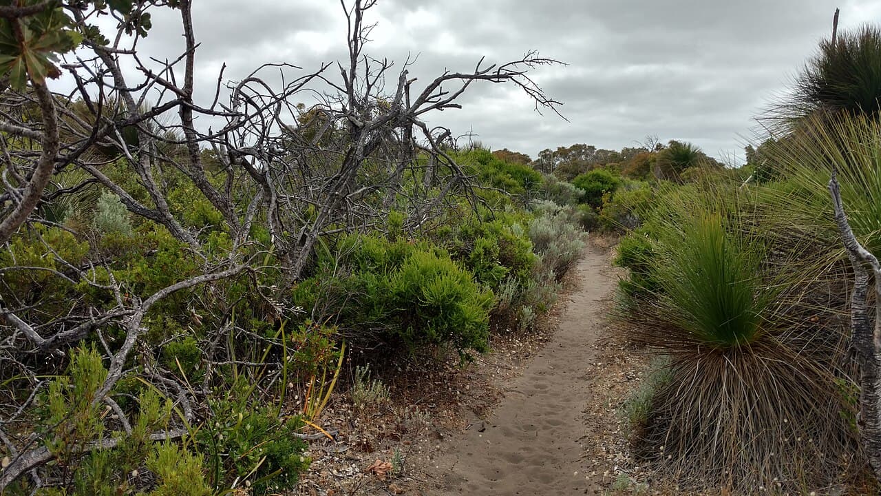
Photo: Lasthib, CC BY-SA 4.0 · via Wikimedia Commons
Coming into Smiths from the north is the right way to arrive at that beach. You drop down off the headland into the southern end of the bay and the long curve of sand opens up in front of you. There's a car park at the southern end of Smiths where you can finish. Again, you'll need a shuffle or a pickup.
With only one section to walk near Yallingup, this is the one.
Being picked up at the Smiths end, the easiest meeting point is the southern Smiths car park. The workshop is six minutes from there, a sensible place to wait when your lift is running late. Pam will find out where you've walked and have a view on it.
Section 4: Smiths Beach to Moses Rock
Distance: 10km one way Time: 4 to 5 hours Difficulty: Moderate to hard
This is where the track starts to feel like a wilderness walk. South of Smiths the coast gets less developed. You pass Injidup beach, the natural spa headland, then continue south through coastal heath and limestone outcrops to Moses Rock.
The walking is harder here: more sand, more exposed sections, fewer trees. On a hot day in summer it's a slog. In autumn it's beautiful. I've walked it in April when the light was low and the heath was flowering and it was one of the best walks I've done.
Moses Rock is a less-visited beach. The car park at the end is a dirt road off Caves Rd and not many people make the drive. If you can arrange a pickup at Moses, this is a properly remote-feeling day walk.
Bring more water than you think you need. There's no shade on most of this section and the southwesterly will dry you out faster than the temperature suggests.
free things to do in Margaret River
Section 5: The longer day, Cape Naturaliste to Yallingup
Distance: 11km one way Time: 5 to 6 hours Difficulty: Moderate
To do a proper day on the track without committing to overnight, link sections 1 and 2. Start at the lighthouse, walk to Sugarloaf, continue to Yallingup. Get picked up at Yallingup or stay overnight in town.
This is the section I'd recommend for a fit walker who has one full day. You see the most varied terrain of the northern track: headland, heath, farm country, dramatic coastline. You finish in Yallingup, which is a good place to have a beer.
The Cape to Cape walk. No cost, no booking, just you and 135km of coastline that makes you realise why I've never wanted to live anywhere else.
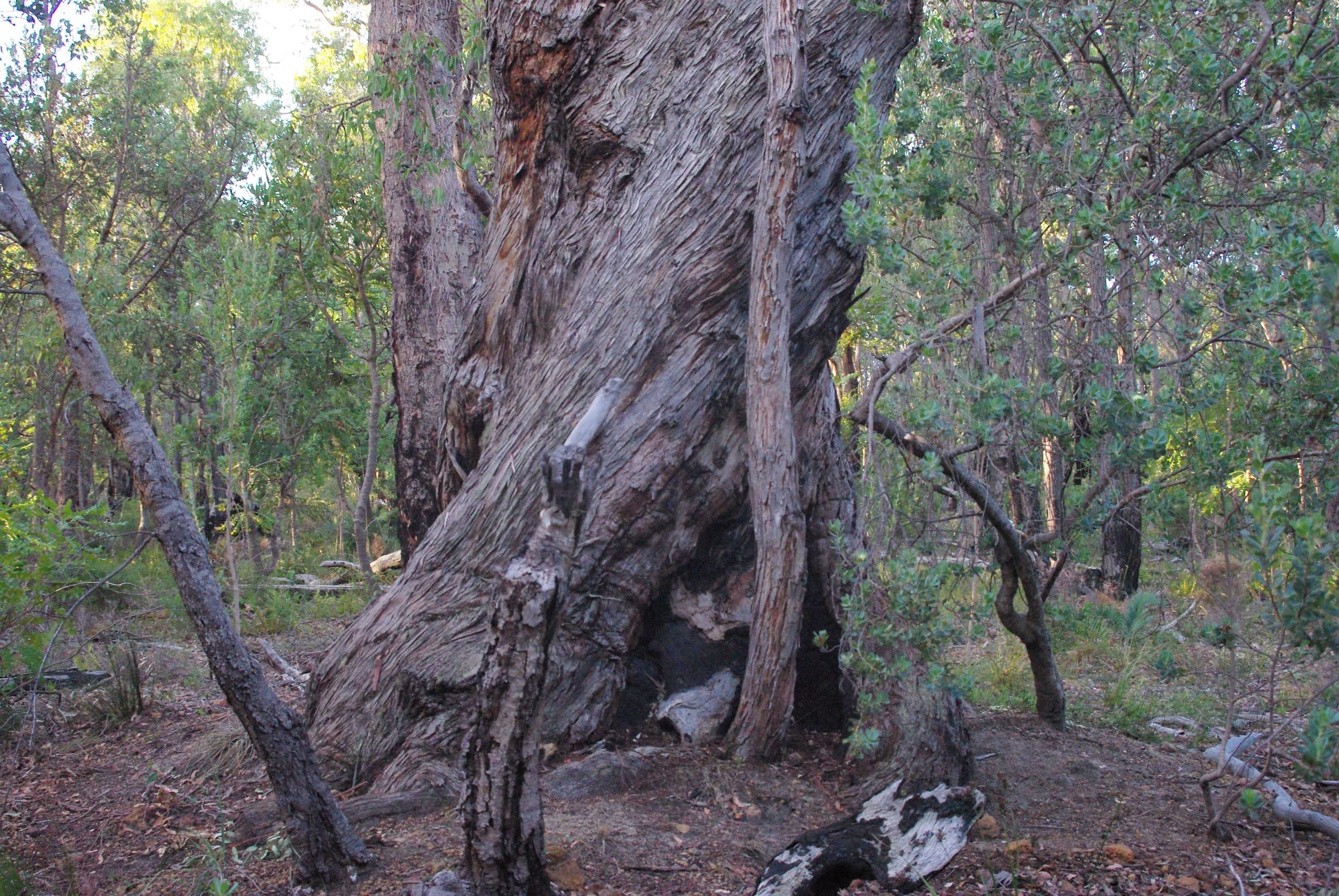
A note on the karri
Most of the track near Yallingup is coastal heath and limestone. The karri forest sections require going south. Boranup karri forest is the famous bit and that's a different kind of walk altogether. The day sections near Yallingup are about the coast.
If you've got a week and you want both, do a few days near here and then drive south to Boranup for a day in the trees. The contrast is the whole point of the track.
Practical bits
What the walk does to you
Forty years of walking this coast and I still go back. The Cape to Cape track is the reason. Even before it was officially a track, before the markers and the maps and the signage, this was the path people followed to get from one bay to the next. It's an old line through the landscape.
What the walk does is recalibrate you. After a few hours on the track you stop thinking in towns and roads and start thinking in headlands and bays. The coast organises itself differently when you're on foot. You notice how the granite changes colour from north to south. You notice where the heath gives way to peppermint trees. You notice the wind shift as you come round each headland.
I take a lot of what I see on those walks back into the workshop. Not consciously. I'm not standing on a clifftop thinking about table designs. But the rhythm of the coast gets into the wood somehow. The way a piece of jarrah grain runs reminds me of a section of track I walked a week ago. It's not mystical, it's just that you can't spend a lifetime walking the same coast and not have it become part of how you see.
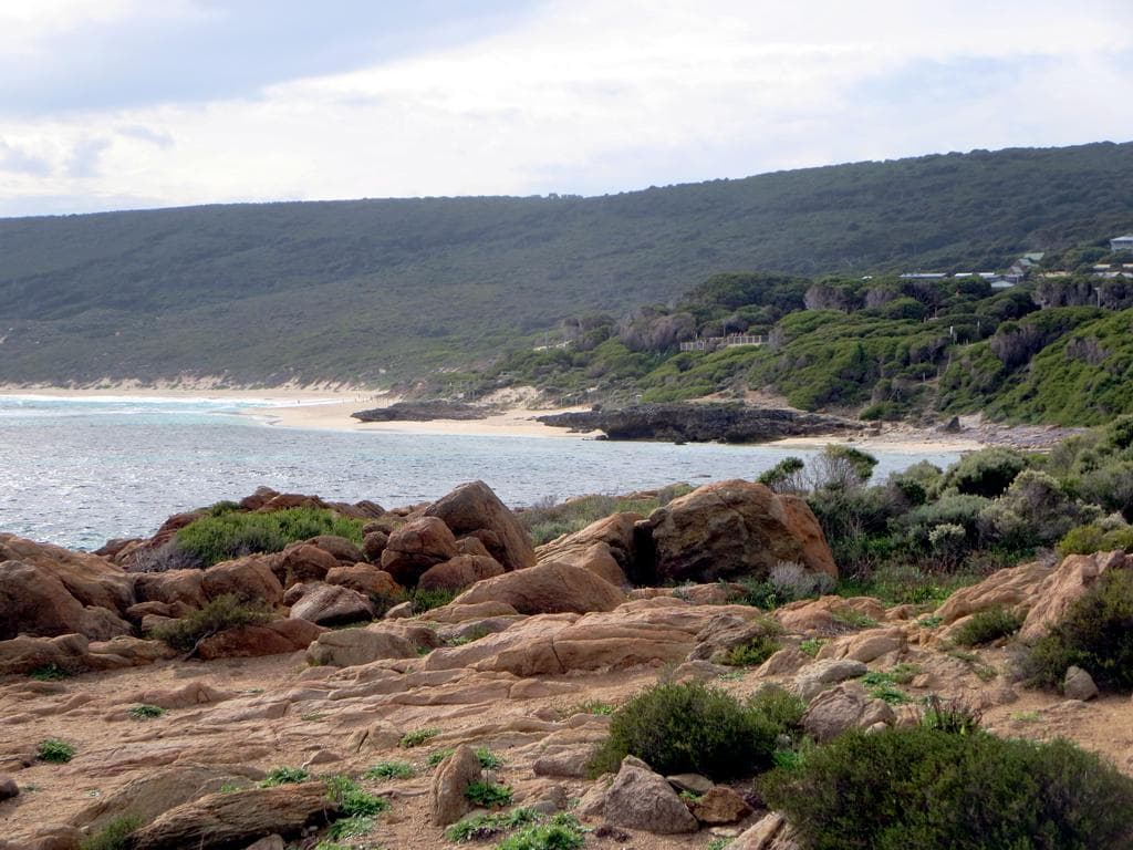
Photo: David Stanley, CC BY 2.0 · via Wikimedia Commons
Closing thought
If you can only walk one section near Yallingup, walk Yallingup to Smiths.
If you can walk two, add Cape Naturaliste to Sugarloaf at the other end.
If you've got a week, walk one section a day and let the place catch up with you. Take afternoons off. Sleep in town. The track isn't going anywhere.
The gallery on Blythe Rd is between most of these sections. Open most days till 5pm. If you've finished a walk and want a coffee in a building made of jarrah and limestone, come past. Google Maps sometimes misdirects via Wildwood Rd. Stay on Bussell Hwy, turn at the Carbunup store, then Blythe Rd.
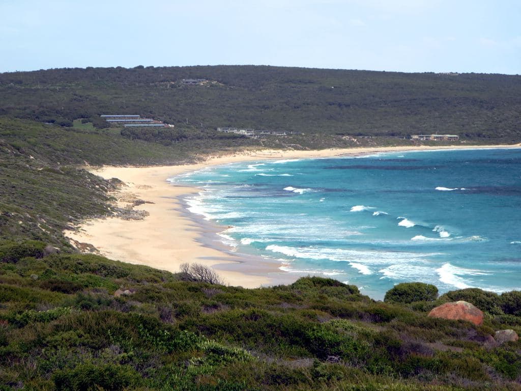
Photo: David Stanley, CC BY 2.0 · via Wikimedia Commons
The walkers who stop in Yallingup at the end of a section have a better story than the ones who drive past. That's not a sales pitch. That's just what I've noticed since 1982, watching people finish their walks here.
Read next: the Cape to Cape Track write-up.
Plan your visit to Yallingup.
Directions & hours →